Stone shaped by time
Where vegetation thins in rain-shadow basins and along wave-scoured benches, bare rock becomes the primary storyteller. Ash-flow tuffs, basaltic dikes, and honeycombed marine sandstones display intricate patterns of fracture and differential weathering that shift dramatically as the sun moves across the sky.
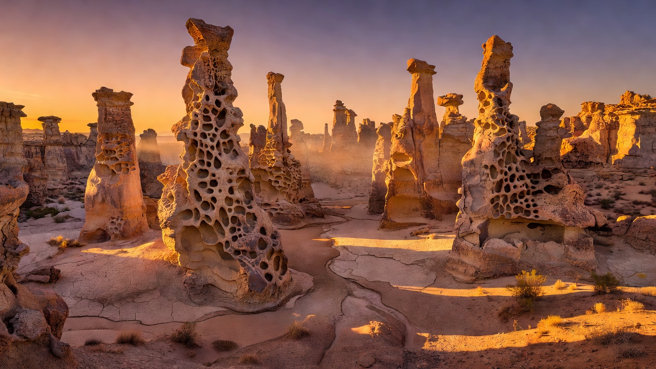
Leslie Gulch Rhyolitic Tuff Pinnacles
Approach via Succor Creek & McBride Road
From Jordan Valley or Homedale, Idaho, follow US-95 to the signed Succor Creek State Natural Area / Leslie Gulch turnoff on McBride Creek Road. After 9 miles on graded gravel, turn west onto the Leslie Gulch Road and descend 15 miles and 2,000 vertical feet into the canyon toward Owyhee Reservoir.
Stop at the signed Juniper Gulch (Mile 10.2) and Timber Gulch trailheads. Never enter the canyon road if heavy convective thunderstorms are forecast; flash runoff down dry side washes carries boulders across the roadbed within minutes. Keep all vehicles strictly on established gravel turnouts.
Side-Lighting Honeycomb Cavities & Lichen
The ash-flow tuff of the Mahogany Mountain caldera is stippled with vibrant chartreuse Rhizocarpon crustose lichens and deep iron-oxide bands. Direct overhead sun flattens the cavernous pockets (tafoni) into harsh black holes.
Work in the final hour before sunset when low-angle amber light grazes the western faces of Dago Gulch and Juniper Gulch, or photograph upward from shaded canyon washes where warm reflected light from the opposite canyon wall illuminates the shadowed underbellies of the spires.
Fort Rock Tuff Ring & Shore Acres Tilted Sandstones
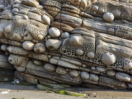
Shore Acres Spherical Concretions
South of Charleston on the Cape Arago Highway, tilted sandstone strata house cannonball-sized mineral concretions and intricate salt-fretted lacework best studied at a minus low tide.
Phreatomagmatic Architecture in the High Desert
Rising 325 feet above the flat sagebrush floor of the Christmas Valley basin in northern Lake County, Fort Rock is a classic volcanic maar—formed when rising basaltic magma encountered the shallow waters of a Pleistocene pluvial lake, blasting rings of consolidated palagonite tuff into the sky. Wave action from the ancient lake later breached the southern wall and carved horizontal terraces along the outer cliffs.
Low-Impact Desert Protocol: Between the sagebrush bushes of the Fort Rock and Owyhee basins lies dark, bumpy biological soil crust composed of cyanobacteria, mosses, and lichens. Walk single-file down dry gravel washes or established paths so you never crush these living soil binders.