Following the falling water
A waterfall sits at the intersection of hard caprock and an eroding underlayer. To reach cascades that lie off the main highway corridor, you usually walk downward—leaving dry ridge timber to enter cool, high-humidity microclimates where footing shifts from pine needles to wet clay and polished cobble.
Abiqua Creek Basalt Amphitheater & Upper Tiers
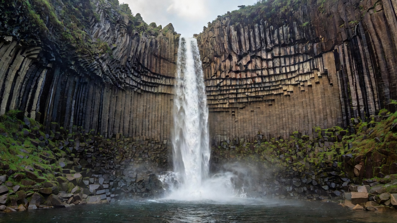
Approach from Crooked Finger Road
From Silverton, Oregon, follow East Main Street onto Oak Street and continue east on Crooked Finger Road for 11.8 miles until the pavement transitions to gravel. Turn right onto a signed timber road (open to daytime public entry by courtesy of Santiam State Forest / private timberland agreement; strictly no overnight camping or fires).
After 2.1 miles on gravel, low-clearance sedans should park at the wide upper turnout before the steep, deeply rutted pitch. High-clearance 4WD vehicles can proceed an additional 0.6 miles to the gated landing. From the gate, walk 150 yards to the trail drop-off on the right. Descend the steep timbered rib utilizing Exposed Douglas-fir roots and fixed courtesy ropes, then walk upstream 0.25 miles along the boulder-strewn creek bed to the amphitheater basin.
Capturing Hexagonal Jointing & Spray
The amphitheater faces northwest inside a deep box canyon. Direct afternoon sun creates harsh diagonal shadow lines across the basalt columns. Arrive under high overcast skies or before 10:30 AM so the wet columns reflect even slate-violet sky tone.
Attach a circular polarizer rotated to remove approximately 70% of surface sheen—leaving enough moisture reflection to show the three-dimensional facets of the rock without washing out the dark stone. A shutter speed between 1/4 second and 1/2 second preserves braided water texture in the 92-foot freefall without turning the plunge pool into featureless white cotton.
Sweet Creek & Beaver Creek Tiered Ledges
Unlike the vertical volcanic plunges of the Cascades, Coast Range streams cut across horizontal beds of Tyee Formation sandstone. Along Sweet Creek south of Mapleton, the water drops over eleven successive ledges framed by bigleaf maple, maidenhair fern, and dark submerged alder snags.
-
Homestead Trailhead Entry (Mile 0.0)
Begin at the lower Homestead parking pullout on Sweet Creek Road (Forest Road 48) 10.5 miles south of Highway 126. The initial path hugs the riparian terrace under dense alder shade.
-
Sandstone Alcove Traverses (Mile 0.4)
Elevated boardwalks and stone steps pass directly beside mid-stream cascades where water swirls through circular potholes ground by trapped basalt cobbles.
-
Beaver Creek Confluence (Mile 1.1)
Look beyond the primary viewing platform toward the shaded side drainage of Beaver Creek, where quieter two-tiered shelves receive soft green canopy bounce light.
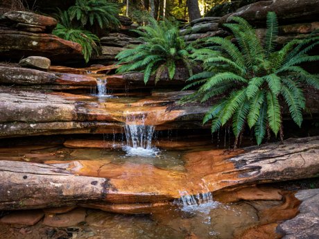
Composing Swirl Patterns
Autumn rains leach organic tannins from fallen maple leaves, tinting the pools warm amber and creating delicate white foam eddies that trace circular exposures during 2-second to 4-second shutter exposures.
Clearwater & Whitehorse Moss-Fed Springs
Along the North Umpqua corridor, porous Pleistocene basalt lavas sit atop impermeable older pyroclastic rocks. Snowmelt percolates through the upper lava flows for years before emerging directly out of mossy canyon walls at a constant 39°F—ensuring consistent flow even during late August drought when surface runoff waterfalls dry to a trickle.
Clearwater Falls Boulder Garden
Located 4 miles south of Lemolo Lake junction off Highway 138 via Forest Road 4785. Water erupts directly from beneath moss-draped nurse logs, dividing into dozens of silver ribbons across emerald bryophyte mounds.
Toketee North Fork Gorge
Carved through a colonnade and entablature lava flow, the North Umpqua River squeezes through a 15-foot notch before dropping 113 feet in two stages. Visit during winter drizzle when crowds vanish and basalt darkens.
Staying on Consolidated Rock
Spring-fed moss cushions take decades to colonize vertical cliff seeps. Never step onto green vegetated cushions along the water's edge; position tripods strictly on bare cobble or established timber platforms.
Seasonal Flow & Shutter Speed Matrix
Matching exposure times to water volume and viewing distance preserves natural motion without losing structural detail in the water column.
| Waterfall Character | Distance from Lens | Recommended Shutter Speed | Key Visual Result |
|---|---|---|---|
| High-Volume Spring Snowmelt Plunge | 60 to 150 feet | 1/15 sec to 1/4 sec | Retains raw energy and individual water spikes while smoothing chaotic spray |
| Low-Flow Summer Horsetail Veil | 40 to 100 feet | 1/2 sec to 1.5 sec | Connects delicate water threads across dark columnar basalt facets |
| Foreground Eddy & Tannin Foam Swirl | 3 to 12 feet | 2 sec to 6 sec | Draws continuous calligraphic arcs in rotating pool bubbles |
| Windy Canyon Rim with Fern Foregrounds | Composite / Dual Frame | 1/60 sec (foliage) + 1/2 sec (water) | Prevents motion blur in streamside maidenhair ferns while softening water |